
Page 1
The Northeast Kingdom — the 2,000-square-mile real estate jewel that
occupies the extreme northeast corner of Vermont — was lovingly nick-
named more than fifty years ago by a former Vermont governor and U.S.
senator for its stunning beauty,
charm and independent spirit.
It is without a doubt the Green
Mountain state’s most beautiful
and undisturbed region. Com-
prised of Orleans, Essex and
Caledonia counties, the North-
east Kingdom accounts for
nearly one-fifth of the state’s
land area but only one-tenth of
its population. For those who
love bicycling this is an irresistible combination — and region — that
compels exploration by bicycle!
The Vermonter’s Vermont and great cycling
Vermont has long been recognized as an international cycling destina-
tion. Our scenery, quiet back roads, and hospitable accommodations have
earned us this status. The Northeast Kingdom does not disappoint! Here,
our scenery, roads and lodging are superla-
tive. Here, too, you will find the
Vermonter’s Vermont and great cycling.
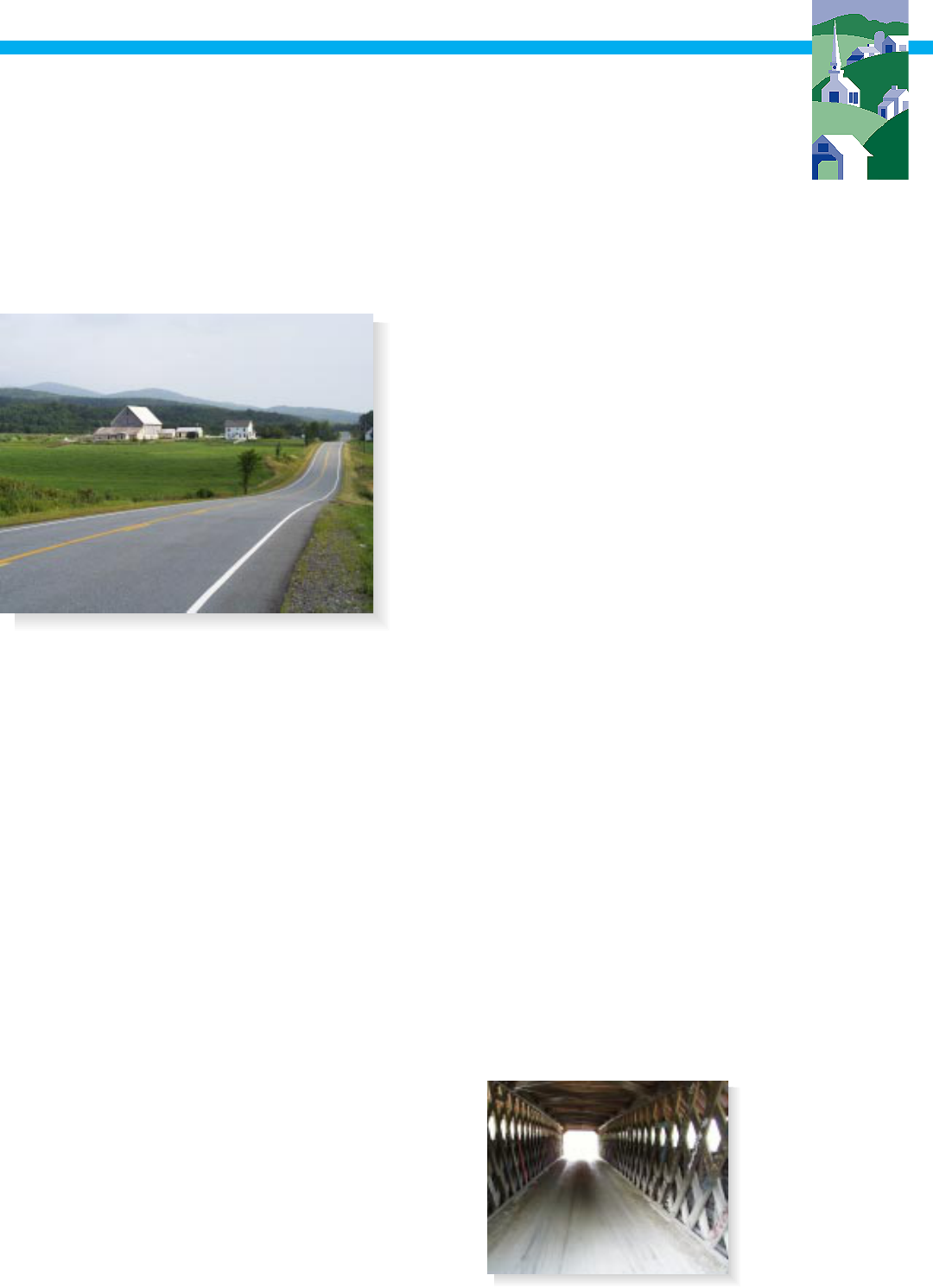
Everywhere you look scenery abounds!
Expansive views of rolling fields, high-
lands and valleys, thick evergreen forests,
and pristine glacial lakes predominate.
Black and white cows dot green pastures.
Heres all the
information youll
need to plan your
cyling excursion in
the Northeast
Kingdom:
Network Map 7
Loops
Around the Block 8
Back Roads to Big Falls 9
Beebe Spur n Spin 10
Craftsbury Classic 11
Glacial Lakes 12
Magnificent Maples 13
Mostly Moose 14
Pedal to Peacham 15
North-South Links
North-South Link 1 16
North-South Link 3 17
North-South Link 5 18
North-South Link 7 19
North-South Link 91 20
East-West Links
East-West Link 2 21
East-West Link 4 22
East-West Link 6 23
Resources
Lodging 24
Camping 27
Bicycle Shops 28
Bicycle Touring Companies 28
Bicycle Touring Guidebooks 29
Bicycle Touring Maps 29
Trail Associations 30
Travel Information 30
Chambers of Commerce 30
For More Information 30
Cycling in the Kingdom
Bicycling Loops and Links
in Vermont’s Northeast
Kingdom
Northeastern Vermont Development Association
NVDA

Page 2
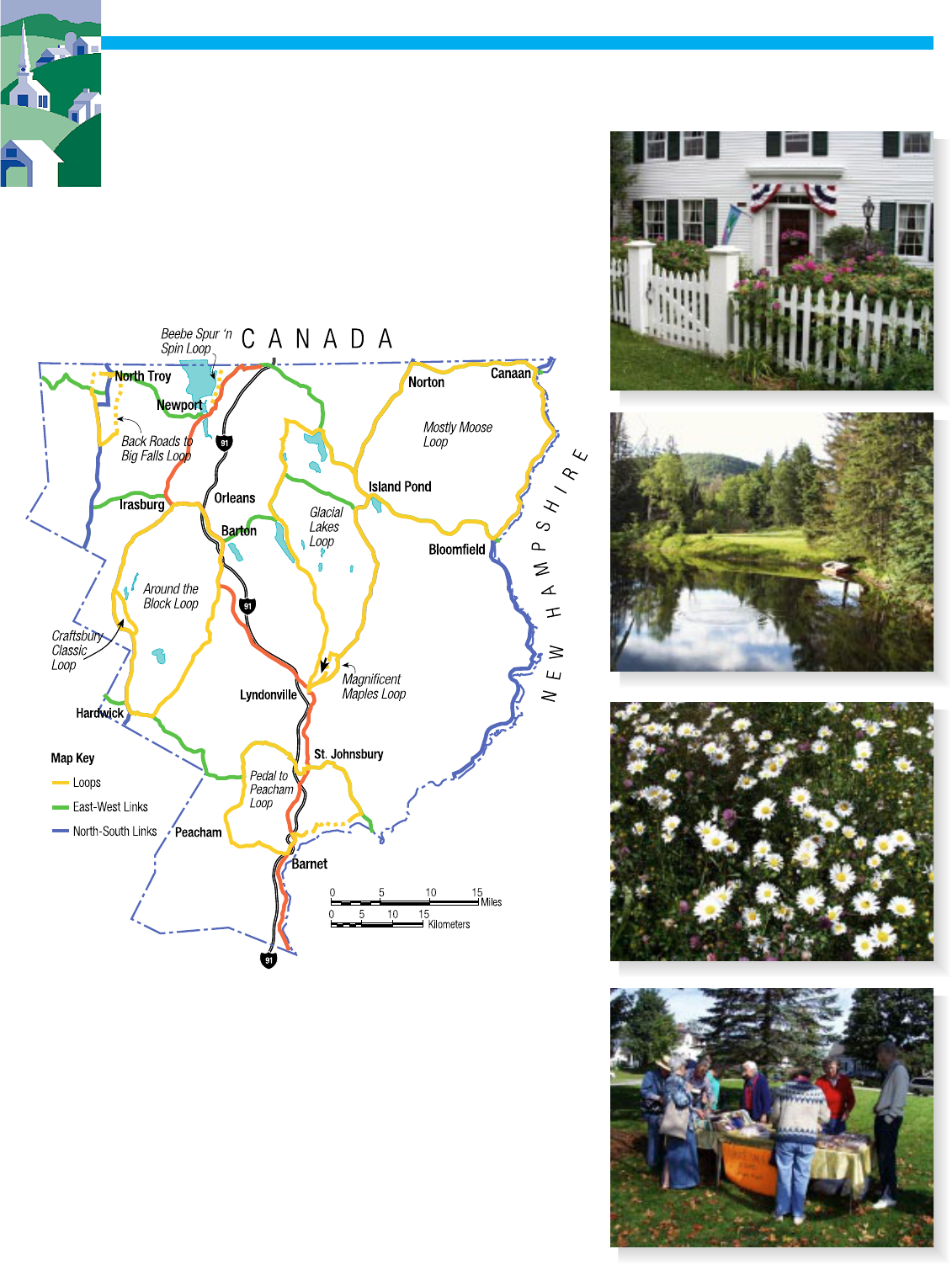
Weathered covered bridges vault
across rushing mountain streams.
Crisp white church steeples accent
maple-crested mountains, and
quaint New England villages take
you back in time.
Then there are our roads — ah,
the roads. Whether paved or not, the roads here actually seem to beckon
you, inviting you to see what’s around the bend or over the next hill. Yes,
there are hills, but with a multi-geared bicycle and time on your hands no
hill is insur-
mountable. With
a little study, and
the help of this
guide, you’ll
soon discover
you can choose a
route that suits
both your ability
and your interest.
Add to this a
good supply of
hospitable coun-
try inns, bed and
breakfasts, and lakeside campgrounds and you have all the ingredients for
an ideal cycling environment.
So come and discover what bicycle touring was meant to be and the way
it still is — in the Northeast Kingdom of Vermont!
Cycling in the Kingdom: Bicycling Loops and Links in Vermont’s Northeast Kingdom is a
project of the Northeastern Vermont Development Association, with funding provided by the
Vermont Transportation Planning Initiative. Project consultants include the Bicycle Federation
of America, Wilbur Smith Associates, and Graphic Solutions. All photos by Bruce Burgess.
Information is accurate as of September 2000. Send suggestions, corrections and updates to
Northeastern Vermont
Development Association (NVDA)
P.O. Box 630, St. Johnsbury, VT 05819
Phone: (802) 748-5181, Fax: (802) 748-1223
E-mail: [email protected]
NVDA

Page 3
Loops
East-West LinksNorth-South Links
Loops and Links
Northeastern Vermont Development Association
NVDA
To get you started, the Northeast Vermont Devel-
opment Association (NVDA) has developed a net-
work of bicycle “loops” and “links” offering ener-
getic beginner through experienced cyclists a range
of distances, challenges and pavement options. Use
the loop routes to plan a ride for a single or multi-day
excursion. Use the links for north-south and east-
west travel or to connect the loops for longer tours
according to your own interest, time, and imagina-
tion.
Whatever route or routes you choose, you’ll find
the Northeast Kingdom will hold your interest for a
day or for an entire vacation.
Also, the routes in this guide have been designed
to supplement, not replace, the treasury of informa-
tion and services that already exists for bicyclists
touring the Northeast Kingdom, so be sure to see the
resource section on page 24.
See combined
network of loops and
links on page 7.
Page 4
The routes in this guide were researched and selected by experienced cyclists who have been planning bicycle
tours in Vermont for nearly two decades. As such, the routes were chosen because they are popular or are pre-
ferred by local cyclists, or provide continuous routes to destinations, or are lightly traveled, or are scenic, or
have more room for cars and bikes, or possess a combination of these attributes.
The routes in this guide utilize existing local, state and
national roadway systems where a range of motor vehicle
volumes, speeds and types (including automobiles trucks, buses,
motorcycles and farm machinery) may be expected. With the
exception of the Beebe Spur ‘n Spin loop, where motor vehicles
are prohibited from using the Beebe Spur rail trail, special
provisions for bicycles should not be expected. Also, the routes
are not signed.
Bicyclists contemplating the use of these materials should
have several years of cycling experience; be able to understand,
appreciate and obey the traffic laws of Vermont; and be capable
of operating their bicycles prudently, with common sense and
reasonable care in shared bicycle/motor vehicle situations.
Using Our Maps and Route Directions
Use this key to match our routes to your ability:
Energetic beginner bicyclist(s). Able to comfort-
ably ride 20 to 30 miles or 3-4 hours a day and prefer
level to gently rolling terrain.
Intermediate cyclist(s). Get regular physical exer-
cise and recently enjoyed bicycling 30 to 40 miles (4-
6 hours) in a day and can handle most terrain.
Advanced cyclist(s). Cycle vigorously when you ride
and regularly enjoy riding 40 to 50 miles or more in 4
to 6 hours over all types of terrain.
Level terrain. Mostly flat terrain averaging less than
4 percent grades. Remember, Vermont is not flat and
even where the terrain is gentle, you are likely to
encounter minor hills and short climbs.
Rolling terrain. Undulating, varied terrain with
grades ranging from 4 to 10 percent. Characterized
by frequent short climbs and descents.
Hilly terrain. Steep grades in excess of 10 percent
and/or extended climbs ranging from 1 to 6 miles in
length. Challenging and/or strenuous cycling should
be expected.
Here are some other things you should know:
Mileages. Every effort has been made to provide
accurate distances on the route directions. However,
actual mileages may vary from user to user depend-
ing on the equipment used. Please report wildly
inaccurate distances to
Railroad tracks. Our maps indicate railroad tracks
where they were observed during our field survey. It
is likely that not every railroad track location was
noted. Therefore, always be vigilant for railroad
crossings. Gaps between the pavement and rails, as
well as slick metal surfaces, can cause you to lose
control of your bicycle and fall. Do not attempt to
“jump” tracks or ride across them at any angle.
Always dismount and walk across railroad tracks.
Covered bridges. Reduced light levels inside a
covered bridge can make it difficult for motorists to
see you and for you
to see gaps between
wooden floor boards
that can cause you to
lose control of your
bicycle and fall.
Dismount and walk
through a covered
bridge if necessary.
Northeastern Vermont Development Association
NVDA
How Our Routes Were Selected

Page 5
Northeastern Vermont Development Association
NVDA
When is peak leaf season in the Northeast Kingdom? Gener-
ally, from the last week of September through Columbus Day in
October, beginning with northern locations and high elevations
and moving southward into lower elevations throughout this
period. For a “leaf peepers” report, call 1-800 VERMONT
during fall foliage season for an up-to-date assessment of color.
What’s the best time to bicycle in the Northeast Kingdom?
Spring arrives during the last week of May when you can expect to
find blossoms on the trees and dandelions in the fields. Summer
comes quickly in June and lingers until Labor Day. The cycling
season usually comes to a close by mid-October.
Are bicycles permitted on all roads? Bicycles may be ridden on all roads in Vermont except where prohibited
by law. In the Northeast Kingdom, bicycles are prohibited on Interstates 91, 93, and a portion of U.S. Route 2
between Danville and St. Johnsbury.
Are there any roads I should avoid? Although many roads have low traffic volumes, higher volumes and
concentrated truck traffic may be experienced along some highways. Cyclists may wish to avoid or seek alter-
nate routes along the following corridors:
U.S. Route 2 (between the Washington / Caledonia County line and West Danville).
U.S. Route 2 (between Route 18 and the intersection of River Road 1.5 miles east of Lunenburg).
U.S. Route 5 (between Newport and Derby Line)
Will I be sharing some roads with logging trucks? One of the attributes of
bicycle touring is that it allows bicyclists to explore the culture of an area as it
exists. One of the cultures, and occupations, of a forested area is logging. So
yes, you may see logging trucks on some roads. Most logging activity, how-
ever, takes place in the winter when the ground is frozen and the logging
skidders won’t sink into the ground, long after the cycling season is over.
Frequently Asked Questions.

Page 6
Let’s Take It Easy Out
There
As attractive as the Northeast Kingdom is for cycling, we all need
to practice safe cycling techniques and appropriate roadway courtesy
to ensure a safe and pleasant experience, free of accident and injury.
Cyclists need the ability to handle themselves and their bicycles
under various situations including grade, surface treatments, obstruc-
tions and hazards, traffic regulations, and the varied conditions
presented by sharing the roadway with motor vehicles. Cycling also
requires good judgment and recognition of existing circumstances
and conditions the cyclist is likely to encounter while cycling. Only
the cyclist knows his or her own ability to cope with certain riding
conditions.
The conditions you encounter while cycling can be infinite. Broken
pavement, potholes and frost heaves may exist where solid, smooth
pavement is expected. Motor vehicles, debris, and dogs may suddenly
seem to appear out of nowhere. Sand, gravel and stop signs may
follow a steep descent without warning. What was, a short time
before, a perfect surface with good lane width and adequate sight
distance may, within a day, have been freshly tarred and graveled
possibly constricting the traveled portion of the roadway or have
become a quagmire of slippery mud precipitated by a blinding down-
pour.
Therefore, as a cyclist, you are responsible for 1) operating your
bicycle both safely and prudently under all conditions, and 2) making
sure the bicycle your are riding is in excellent operating condition.
Northeastern Vermont Development Association
NVDA
IMPORTANT NOTICE: The agencies, orga-
nizations, and individuals involved in develop-
ment of this guide in no way assume liability or
warrant the condition, suitability or appropriate-
ness of the highways indicated for shared bicycle/
motor vehicle use. Users of this guide accept all
responsibility and risks, inherent and not inher-
ent, associated with its use.
Page 7
Northeastern Vermont Development Association
NVDA
Combined Network
of Loops and Links
Loops
Around the Block 8
Back Roads to Big Falls 9
Beebe Spur ‘n Spin 10
Craftsbury Classic 11
Glacial Lakes 12
Magnificent Maples 13
Mostly Moose 14
Pedal to Peacham 15
When combined, our loops and links create a network
of bicycle routes that covers the kingdom
North-South Links
North-South Link 1 16
North-South Link 3 17
North-South Link 5 18
North-South Link 7 19
North-South Link 91 20
East-West Links
East-West Link 2 21
East-West Link 4 22
East-West Link 6 23
Page 8
Northeastern Vermont
Development Association
Distance: 58.7 miles
Terrain: Level, rolling and hilly terrain
Ability levels: Intermediate and ad-
vanced
Conditions: All paved roads
Nearby attractions: Craftsbury
Common: picturesque village setting,
Glover: Bread and Puppet Theater
Museum
Services: Lodging: Barton, Craftsbury,
Craftsbury Common, East Craftsbury,
Greensboro, Greensboro Bend,
Hardwick; Camping: Hardwick; Stores:
Barton, Greensboro, Hardwick; Restau-
rants: Barton, Greensboro, Hardwick
ROUTE DIRECTIONS
CumulativeMiles to
mileage Instructions next turn
0.0 Departing from the junction of Routes 14
and 15 in Hardwick, ride west on Route 15. 1.2
1.2 RIGHT on Route 14. 24.1
25.3 RIGHT on Route 58 in Irasburg. 2.6
27.9 RIGHT on Lake Region Road. 2.2
30.1 RIGHT on Route 5 3.2
33.3 RIGHT on Route 16 in Barton. 4.7
38.0 LEFT on Route 122 1.5 miles south of Glover
to visit Bread and Puppet Theater Museum. 0.8
38.8 Arrive at Bread and Puppet Theater Museum.
After visiting the museum, make a U-TURN on
Route 122 and ride back to Route 16. 0.8
39.6 LEFT on Route 16. 16.5
56.1 RIGHT on Route 15 West. 2.6
58.7 Arrive at the junction of Routes 14 and 15 in
Hardwick.
Around the Block
Around the block is what Vermonters call
making a series of right-hand turns to get back
where they started — even if it takes more
than 50 miles to do it. This one of the favorite
“around the block” rides in all of Vermont.
Suitable for intermediate and
advanced riders. Great scenery.
All paved roads. Some long
gentle climbs and descents but no
major hills.
An overnight stay in either
Irasville or Barton can make this
a two-day ride.
The agencies, organizations, and individuals involved in development
of this guide in no way assume liability or warrant the condition, suit-
ability or appropriateness of the highways indicated for shared bicycle/
motor vehicle use. Users of this guide accept all responsibility and
risks, inherent and not inherent, associated with its use.
NVDA

Page 9
Distance: 22.4 miles
Terrain: Level, rolling
to hilly
Ability levels: Interme-
diate and advanced
Conditions: Combina-
tion of paved and
unpaved roads. Suitable
for mountain bikes and
hybrids
Attractions: Big Falls,
River Road Covered
Bridge
Services: Lodging: Jay, North Troy, Troy;
Camping: Westfield; Stores: Jay, North
Troy, Troy, Westfield; Restaurants: Jay,
North Troy, Troy, Westfield
ROUTE DIRECTIONS
CumulativeMiles to
mileage Instructions next turn
0.0 Departing from Route 100 in Westfield, ride north on
North Hill Road. 4.2
4.2 STRAIGHT on North Jay Road in Jay. 1.7
5.9 STRAIGHT to continue on North Jay Road (unpaved) at
junction of Route 105. North Jay Road becomes paved
in 4.0 miles. 4.4
10.3 STRAIGHT toward village green in North Troy. 0.3
10.6 RIGHT on Route 243 after North Troy business district. 0.1
10.7 LEFT on Route 105. 1.2
12.2 RIGHT on River Road (unpaved). 1.5
13.7 Arrive at Big Falls. After visiting Big Falls, continue
STRAIGHT on unpaved River Road in the direction you
were going. 2.8
16.5 STRAIGHT on unpaved River Road at intersection of
Veilleux Road. Covered bridge and swimming hole on
your right at intersection. River Road becomes paved
in 3.0 miles. 3.9
20.4 RIGHT on Route 100 South. 0.4
20.8 LEFT to continue on Route 100 South in Troy. 1.6
22.4 Arrive at the junction of Route 100 and North Hill Road in
Westfield.
Back Roads to
Big Falls
A combination of lightly traveled paved and
unpaved back roads leads you to the best
waterfall in the region. A covered bridge and
popular swimming hole add to the enjoyment
of this ride. Suitable for mountain bikes and
hybrids as well as intermediate and advanced
riders.
Northeastern Vermont
Development Association
NVDA
The agencies, organizations,
and individuals involved in de-
velopment of this guide in no
way assume liability or warrant
the condition, suitability or ap-
propriateness of the highways
indicated for shared bicycle/
motor vehicle use. Users of this
guide accept all responsibility
and risks, inherent and not in-
herent, associated with its use.

Page 10
Northeastern Vermont
Development Association
NVDA
Distance: 11.2 miles roundtrip departing
from downtown Newport; 7.6 miles roundtrip
departing from IRS parking lot on Prouty
Drive (parking permitted only during non-
business hours)
Terrain: Level
Ability levels: Energetic beginners to ad-
vanced
Conditions: Mountain bikes recommended,
hybrids may work depending on trail surface
conditions
Attractions: Newport: Lake Memphremagog,
Goodrich Memorial Library, Federal Building
Services: Lodging: Newport; Stores: New-
port; Restaurants: Newport; Bike Shop:
Newport
Beebe Spur ‘n Spin
An out-and-back ride along Vermont’s most
scenic rail trail that borders Lake
Memphremagog for most of the trail’s 3.8-
mile car-free length. Suitable for all abilities.
Fat tired bicycles are strongly recommended
due to coarse gravel surface.
Route Directions
CumulativeMiles to
mileage Instructions next turn
0.0 Departing from the Vermont State Office Building
on Main Street (Route 5) in Newport, ride east
on East Main Street (U.S. Route 5 North). 0.5
0.5 STRAIGHT on Union Street at traffic left where
U.S. 5 turns right. 1.1
1.6 LEFT on Prouty Drive. 0.2
1.8 RIGHT on Beebe Spur rail trail. 3.8
5.6 At northern end of rail trail, make a U-TURN and
follow rail trail back to Prouty Drive. 3.8
9.4 LEFT on Prouty Drive at southern end of rail trail.
0.2
9.6 RIGHT on Union Street. 1.1
10.7 STRAIGHT on U.S. Route 5 South. 0.5
11.2 RIGHT at Vermont State Office Building on Main
Street to complete ride.
The agencies, organizations, and individuals involved in development of this guide in no way assume liability or warrant the
condition, suitability or appropriateness of the highways indicated for shared bicycle/motor vehicle use. Users of this guide
accept all responsibility and risks, inherent and not inherent, associated with its use.

Page 11
Distance: 10.9 miles
Terrain: Level to rolling with one
major hill
Ability levels: Energetic beginners to
advanced
Conditions: All paved roads
Attractions: Craftsbury Common:
picturesque village
Services: Lodging: Craftsbury,
Craftsbury Common; Stores:
Craftsbury
Route Directions
CumulativeMiles to
mileage Instructions next turn
0.0 Departing from the U.S. Post Office in Craftsbury, ride
north on South Craftsbury Road toward Craftsbury
Common. South Craftsbury Road becomes North
Craftsbury Road in Craftsbury Common. 3.8
3.8 LEFT on Route 14. 5.5
9.3 LEFT on South Craftsbury Road. 1.6
10.9 Arrive at U.S. Post Office in Craftsbury.
Craftsbury Classic
A perfect introduction to cycling in the North-
east Kingdom featuring all paved roads.
Classic inns, country stores, intimate scenes
and sweeping panoramas accent the verdant
landscape. The mostly level to rolling terrain
is interrupted by only one killer hill. But hey,
Vermont ain’t flat. Do-able by beginners, and
enjoyable by intermediates and advanced
cyclists looking for a delightful warm-up or
short training ride.
Northeastern Vermont
Development Association
NVDA
The agencies, organizations, and individuals involved in development of this guide in no way assume liability or warrant the condition, suitability or
appropriateness of the highways indicated for shared bicycle/motor vehicle use. Users of this guide accept all responsibility and risks, inherent and not
inherent, associated with its use.

Page 12
Glacial Lakes
Don’t leave the Kingdom without visiting two of its most beautiful glacial lakes — Willoughby and
Seymour. The all-paved roads on this ride take in both of them including Island Pond. Stunning
scenery. Aromatic evergreens. This is quintessential Northeast Kingdom.
Good accommodations enable you to make this a multi-day tour. For a two-day tour, ride from
Lyndonville to Seymour Lake in Morgan (33.8 miles), then back to Lyndonville on the following
day (35.1 miles). For a three-day tour, ride from Lyndonville to Island Pond (24.2 miles), Island
Pond to Lake Willoughby (24.7), and Lake Willoughby back to
Lyndonville (20.0 miles).
Distance: 68.9 miles Terrain: rolling to hilly Ability
levels: Intermediate to advanced
Conditions: All paved roads, railroad tracks as shown
Attractions: Island Pond: Brighton State Park, Island
Pond Museum; Lyndonville: Sanborn Covered Bridge,
Miss Lyndenville Diner
Services: Lodging: East Burke, Island Pond,
Lyndonville, Morgan Center, West Burke, Westmore;
Camping: Island Pond
Westmore; Stores: East
Burke, Island Pond,
Lyndonville, Morgan,
Morgan Center, West
Burke, West Charles-
ton, Westmore; Restau-
rants: East Burke,
Island Pond,
Lyndonville, Westmore
Northeastern Vermont
Development Association
NVDA
ROUTE DIRECTIONS
CumulativeMiles to
mileage Instructions next turn
0.0 Departing from Lyndonville, ride north on U.S. Route 5. 0.9
0.9 RIGHT on Route 114. 4.6
5.5 STRAIGHT to continue on Route 114 North in East Burke. 16.5
22.0 RIGHT on combined Routes 114 and 105 toward Island Pond. 2.2
24.2 LEFT on Route 114 in Island Pond. 2.9
27.1 LEFT on Route 111. 6.7
33.8 STRAIGHT to continue on Route 111 in Morgan Center. 3.8
37.6 LEFT on Gore Road South 2.0 miles beyond Morgan Four
Corners. Gore Road South becomes Durgin Road at the
Charleston town line. 2.2
39.8 LEFT on Route 105 in West Charleston. 0.9
40.7 RIGHT on Route 5A South. 8.2
48.9 STRAIGHT to continue on Route 5A South at Lake
Willoughby and junction of Route 16. 11.6
60.5 STRAIGHT on Route 5 South in West Burke. 7.5
68.0 RIGHT to continue on Route 5 South at Junction of Route 114. 0.9
68.9 Arrive in Lyndonville.
The agencies, organizations, and individuals involved in development of this guide in no way assume
liability or warrant the condition, suitability or appropriateness of the highways indicated for shared
bicycle/motor vehicle use. Users of this guide accept all responsibility and risks, inherent and not inher-
ent, associated with its use.

Page 13
Northeastern Vermont
Development Association
NVDA
Magnificent Maples
The views and vistas along Darling Hill Road
— the main event of this ride — are unsur-
passed. Century-old sugar maples form a
canopy of color during foliage season and a
respite from the sun in spring and summer.
Perfect for all abilities. Don’t be detered by the
hill out of East Burke; you’ll be amply awarded
for your efforts! Even skinny tired bikes can
handle the unpaved roadway near the Inn at
Mountain View Creamery and the Wildflower
Inn.
Distance: 11.4 miles
Terrain: Level to rolling with one major hill
Ability levels: Energetic beginners to ad-
vanced
Conditions: Paved and unpaved roads.
Suitable for road and mountain bikes and
hybrids. Railroad tracks as shown
Attractions: Lyndonville: Sanborn Covered
Bridge (and real estate office), Millers Run
Covered Bridge
Services: Lodging: East Burke, Lyndonville;
Stores: East Burke, Lyndonville; Restaurants:
East Burke, Lyndonville; Bike Shops: East
Burke, Lyndonville
Route Directions
Cumm. Miles to
mileage Instructions next turn
0.0 Departing from Lyndonville, ride north
on U.S. Route 5. 0.9
0.9 RIGHT on Route 114. 4.6
5.5 LEFT on East Darling Hill Road in East
Burke. 0.8
6.3 LEFT on Darling Hill Road. Darling Hill
Road becomes unpaved in 0.4 mile and
remains unpaved for 1.7 miles. 3.5
9.8 RIGHT on Route 114. 0.7
10.5 LEFT on Route 5 toward Lyndonville. 0.9
11.4 Arrive in Lyndonville.
The agencies, organizations, and individuals involved in development of this guide
in no way assume liability or warrant the condition, suitability or appropriateness of
the highways indicated for shared bicycle/motor vehicle use. Users of this guide
accept all responsibility and risks, inherent and not inherent, associated with its use.

Page 14
Mostly Moose
And trees. Not much else, includin’
traffic, ‘cept scen’ry. We saw four
moose without hardly looking when
scouting this loop. Fairly level when riding north and
south. Bumps and hills east and west. Energetic
beginners, make a two-day trip out of
this one. Others can do it in a day, given
enough time and daylight. Paved roads
run the gamut from sometimes rough to
delightfully smooth.
Distance: 67.5 miles
Terrain: level, rolling and hilly
Ability levels: Energetic beginner through
advanced
Conditions: Paved roads (condition varies);
narrow underpass 4.8 miles north of Island
Pond on Route 114; Railroad tracks as shown
Attractions: Cannan: Alice M. Ward Memorial
Library; Island Pond: Island Pond Museum,
Brighton State Park; Lemington: Columbia
Covered Bridge
Services: Lodging: Averill, Canaan,
Island Pond, Wallace Pond; Camping:
Island Pond; Stores: Averill, Cannan,
Island Pond, Norton; Restaurants:
Canaan, Island Pond, Norton
Route Directions
Miles
Cumulativeto next
mileage Instructions turn
0.0 Departing from the
junction of Routes
114 and 105 in
Island Pond, ride
north on Route
114. 16.5
16.5 RIGHT on Route
114 in Norton. 13.6
30.1 RIGHT on Route
102 in Canaan. 21.1
51.2 RIGHT on Route
105 in Bloomfield. 16.3
67.5 Arrive at the
junction of Routes
114 and 105 in Island
Pond.
The agencies, organizations, and individuals involved in development of this guide in no way assume liability or warrant the condition, suitability or
appropriateness of the highways indicated for shared bicycle/motor vehicle use. Users of this guide accept all responsibility and risks, inherent and not
inherent, associated with its use.
Northeastern Vermont
Development Association
NVDA

Page 15
Distance: 48.2 miles
Terrain: Rolling to hilly
Ability levels: Intermediate to advanced
Conditions: Mostly paved roads except for 4.5
miles between Barnet and Lower Waterford.
Railroad tracks as shown
Attractions: Barnet Center: Barnet Center
Historic District; Peacham: picturesque
Peacham Village; St. Johnsbury: Fairbanks
Museum and Planetarium, St. Johnsbury
Athenaeum
Services: Lodging: Barnet, Danville, Lower
Waterford, St. Johnsbury; Camping: Danville,
St. Johnsbury, West Barnet; Stores: Barnet,
Danville, Peacham, South Peacham, St.
Johnsbury; Restaurants: Danville, St.
Johnsbury; Bike Shops: St. Johnsbury
Route Directions
CumulativeMiles to
mileage Instructions next turn
0.0 Departing from the Aetheneum in St. Johnsbury, ride west
on U.S. Route 2. 0.2
0.2 RIGHT to continue on U.S. Route 2 West. 0.6
0.8 STRAIGHT to continue on U.S. Route 2 at junction of Route 2B. 1.5
2.3 RIGHT on North Danville Road (Town Highway 7)
immediately before U.S. Route 2 becomes a controlled
access highway. 3.6
5.9 LEFT on Bruce Badger Memorial Highway in North
Danville. 5.0
10.9 STRAIGHT on Peacham / Bailey-Hazen Road in Danville
at junction of U.S. Route 2. 7.1
18.0 STRAIGHT to continue on Bailey-Hazen Road in
Peacham. 1.0
19.0 LEFT on Peacham-Barnet Road in South Peacham. 1.4
20.4 STRAIGHT (bear right) on West Barnet Road in West
Barnet. 5.0
25.4 LEFT on Church Street in Barnet. 0.4
25.8 LEFT on U.S. Route 5 North in Barnet. 2.4
28.2 RIGHT on Commerford Dam Road (becomes Lower Waterford
Road in 4.4 miles). Commerford Dam Road becomes unpaved
in 2.0 miles, remains unpaved for 0.6 miles, becomes paved for
0.6 miles and remains unpaved for another 3.9 miles before
becoming paved again. 9.9
38.1 LEFT on Route 18. 6.7
44.8 LEFT on U.S. Route 2. 2.9
47.7 LEFT on Route 5. 0.2
47.9 RIGHT on U.S. Route 2. 0.3
48.2 Arrive at Aetheneum in St. Johnsbury.
Pedal to
Peacham
If hills are your “thing,” this
is the ride for you. Long
climbs, narrow roads and
fast descents will challenge even the most
experienced riders. Picturesque villages and
real country stores remind us of the way
Vermont once was, and still is in this region,
when we leave the beaten path. Don’t leave
the road bike at home
just because they’re a
few dirt stretches.
You’ll want the narrow
tires and all the gears for
the rest of the tour.
Exciting for advanced
cyclists, challenging for
the rest of us.
Northeastern Vermont
Development Association
NVDA
The agencies, organizations, and individuals involved in development of this
guide in no way assume liability or warrant the condition, suitability or appropri-
ateness of the highways indicated for shared bicycle/motor vehicle use. Users
of this guide accept all responsibility and risks, inherent and not inherent, asso-
ciated with its use.

Page 16
North-South Link 1
NORTH-SOUTH LINK 1, SOUTHBOUND
CumulativeMiles to
mileage Instructions next turn
0.0 From Canadian border and U.S. Customs in Beecher
Falls, STRAIGHT on Route 253. 2.2
2.2 STRAIGHT on Route 102 South in Canaan. 21.1
23.3 STRAIGHT on Route 102 South in Bloomfield. 15.9
39.2 RIGHT to continue on Route 102 in Guildhall. 7.4
46.6 STRAIGHT on U.S. Route 2 West. 4.0
50.6 STRAIGHT (left) on River Road toward South
Lunenburg. 5.7
56.3 LEFT across bridge in Gilman to New Hampshire.
NORTH-SOUTH LINK 1, NORTHBOUND
CumulativeMiles to
mileage Instructions next turn
0.0 From bridge in Gilman, RIGHT on Commercial Avenue
(River Road) toward South Lunenburg. 5.7
5.7 STRAIGHT (right) on U.S. Route 2 East. 4.0
9.7 STRAIGHT on Route 102. 7.4
17.1 LEFT to continue on Route 102 in Guildhall. 15.9
33.0 STRAIGHT on Route 102 in Bloomfield. 21.1
54.1 STRAIGHT on Route 253 in Canaan. 2.2
56.3 Arrive at U.S. Customs and Canadian border in Beecher Falls.
The agencies, organizations, and individuals involved in development of
this guide in no way assume liability or warrant the condition, suitability or
appropriateness of the highways indicated for shared bicycle/motor ve-
hicle use. Users of this guide accept all responsibility and risks, inherent
and not inherent, associated with its use.
Northeastern Vermont
Development Association
NVDA
Distance: 56.3 miles
Terrain: Level to rolling
Ability levels: Energetic beginner to advanced
Conditions: Paved roads
Attractions: See directions for Mostly Moose loop; historic
village and green in Guildhall, Columbia Covered Bridge
near Lemington, Mt. Orne Covered Bridge near South
Lunenburg
Services: Lodging: Canaan, Guildhall; Stores: Canaan,
Bloomfield

Page 17
North-South Link 3
Northeastern Vermont
Development Association
NVDA
NORTH-SOUTH LINK 3, SOUTHBOUND
CumulativeMiles to
mileage Instructions next turn
0.0 From Canadian border and U.S. Customs in Norton,
STRAIGHT on Route 114. 16.5
16.5 RIGHT on combined Routes Route 114 and 105 in Island
Pond. 2.2
18.7 LEFT on Route 114 at junction of Route 105. 21.1
39.8 Connect with North/South Link 91 at junction of U.S.
Route 5.
NORTH-SOUTH LINK 3, NORTHBOUND
CumulativeMiles to
mileage Instructions next turn
0.0 From North/South Link 91 at junction of U.S. Route 5,
ride NORTH on Route 114. 21.1
21.1 RIGHT on combined Routes 114 and 105. 2.2
23.3 LEFT on Route 114 in Island Pond. 16.5
39.8 Arrive at U.S. Customs and Canadian border in Norton.
The agencies, organizations, and individuals involved in development of
this guide in no way assume liability or warrant the condition, suitability or
appropriateness of the highways indicated for shared bicycle/motor ve-
hicle use. Users of this guide accept all responsibility and risks, inherent
and not inherent, associated with its use.
Distance: 39.8 miles
Terrain: Level to rolling
Ability levels: Intermediate
and advanced
Conditions: Paved roads,
railroad tracks as noted
Attractions: See directions
for Mostly Moose, Glacial
Lakes and Magnificent
Maples loops
Services: Lodging: Island
Pond, East Burke,
Lyndonville; Camping:
Island Pond; Stores: Norton,
Island Pond, East Burke,
Lyndonville; Bike Shops:
East Burke, Lyndonville

Page 18
North-South Link 5
NORTH-SOUTH LINK 5, SOUTHBOUND
CumulativeMiles to
mileage Instructions next turn
0.0 From East-West Link 4 and North-South Link 91 at the
junction of combined routes 58 and U.S. 5 in Irasburg,
SOUTH on Route 14. 24.1
24.1 LEFT on combined Routes Route 14 and 15. 1.2
25.3 RIGHT on Route 14 at junction of Route 15 in Hardwick. 1.6
26.9 Arrive at Caledonia / Washington County line.
NORTH-SOUTH LINK 5, NORTHBOUND
CumulativeMiles to
Mileage Instructions next turn
0.0 From Washington / Caledonia County line, ride NORTH
on Route 14. 1.6
1.6 LEFT on combined Routes 14 and 15 in Hardwick. 1.2
2.8 RIGHT on Route 14. 24.1
26.9 Arrive at East-West Link 4 and North-South Link 91 at junction
of combined routes 58 and U.S. 5 in Irasburg.
The agencies, organizations, and individuals involved in development of this guide in no way assume liability or warrant the condition, suitability or
appropriateness of the highways indicated for shared bicycle/motor vehicle use. Users of this guide accept all responsibility and risks, inherent and not
inherent, associated with its use.
Distance: 26.9 miles
Terrain: Level to rolling
Ability levels: Intermediate and advanced
Conditions: Paved roads
Attractions: See directions for Around the Block and
Classic Craftsbury loops
Services: Lodging: Irasburg, Albany, Craftsbury
Common, Craftsbury, Hardwick; Stores: Irasburg,
Craftsbury, Hardwick
Northeastern Vermont
Development Association
NVDA

Page 19
NORTH-SOUTH LINK 7, SOUTHBOUND
CumulativeMiles to
mileage Instructions next turn
0.0 From Canadian border and U.S. Customs near North
Troy, STRAIGHT on Route 243.0.9
0.9 RIGHT on Highland Avenue in North Troy. 0.3
1.2 STRAIGHT on Route 105. 2.0
3.2 STRAIGHT on Route 101. 1.3
4.5 RIGHT on Route 242. 1.4
5.9 LEFT on North Hill Road in Jay. 4.2
10.1 STRAIGHT (right) on Route 100 South in Westfield. 6.5
16.6 STRAIGHT on Route 100 South at junction of Route 58
in Lowell. 4.5
21.1 Arrive at Orleans / Lamoille County line.
NORTH-SOUTH LINK 5, NORTHBOUND
CumulativeMiles to
Mileage Instructions next turn
0.0 From Orleans / Lamoille County line, ride NORTH on
Route 100. 4.5
4.5 STRAIGHT on Route 100 North at junction of Route 58 in
Lowell. 6.5
11.0 STRAIGHT (left) on North Hill Road in Westfield. 4.2
15.2 RIGHT on Route 242 in Jay. 1.4
16.6 LEFT on Route 101. 1.3
17.9 STRAIGHT on Route 105. 2.0
19.9 STRAIGHT on Highland Avenue in North Troy. 0.3
20.2 LEFT on Route 243 in North Troy. 0.9
21.1 Arrive at Canadian border.
North-South Link 7
The agencies, organizations, and individuals involved in development of this guide in no way assume liability or warrant the condition, suitability or
appropriateness of the highways indicated for shared bicycle/motor vehicle use. Users of this guide accept all responsibility and risks, inherent and not
inherent, associated with its use.
Northeastern
Vermont
Development
Association
NVDA
Distance: 21.1 miles
Terrain: Level to rolling
Ability levels: Intermediate and advanced
Conditions: Paved roads
Attractions: See directions for Back Roads to Big Falls
loop
Services: Lodging: North Troy, Jay, Westfield; Camping:
Westfield; Stores: North Troy, Jay, Westfield

Page 20
North-South Link 91
Northeastern Vermont Development Association
Distance: 79.8 miles
Terrain: Level to hilly
Ability levels: Intermediate and advanced
Conditions: Paved roads, increased traffic on U.S. Route
5, railroad tracks as shown
Attractions: See directions for Beebe Spur ‘n Spin,
Around the Block, Glacial Lakes and Pedal to Peacham
loops
Services: Lodging: Derby Line, Newport, Irasburg,
Barton, Glover, Lyndonville, Lyndon, St. Johnsbury,
Barnet, McIndoe Falls and Ryegate; Camping: Barton;
Stores: Derby Line, Newport, Irasburg, Barton, Glover,
Lyndonville, Lyndon, St. Johnsbury, Barnet, McIndoe
Falls and Ryegate
NORTH-SOUTH LINK 91, SOUTHBOUND
Cumm.
mileage Instructions Miles to next turn
0.0 From Canadian border and U.S. Customs in Derby Line,
STRAIGHT on U.S. Route 5. 0.2
0.2 RIGHT on Elm Street in Derby Line. 1.9
2.1 RIGHT on Beebe Road. 0.4
2.5 LEFT on Darling Hill Road. 3.1
5.6 LEFT on North Derby Road. 1.6
7.2 RIGHT on Prouty Drive. 0.2
7.4 LEFT on Union Street. 1.1
8.5 STRAIGHT on U.S. Route 5 South in Newport. 0.5
9.0 STRAIGHT on U.S. Route 5 South from the intersection
of Coventry Street in Newport. 6.5
15.5 RIGHT on Route 14 South in Coventry. 3.7
19.2 LEFT on combined Routes 14 and 58. 1.2
20.4 LEFT on Route 58 in Irasburg. 2.6
23.0 RIGHT on Lake Region Road. 2.2
25.2 RIGHT on U.S. Route 5. 3.2
28.4 RIGHT on Route 16 in Barton. 4.7
33.1 LEFT on Route 122 1.5 miles south of Glover. 15.8
48.9 RIGHT on U.S. Route 5 South at junction of Route 114. 0.9
49.8 STRAIGHT on U.S. Route 5 South in Lyndonville. 8.1
57.9 STRAIGHT on Alternate Route 5 in St. Johnsbury. 0.9
58.8 LEFT on U.S. Route 2 East in St. Johnsbury. 0.3
59.1 RIGHT on U.S. Route 5 South in St. Johnsbury. 9.5
68.6 STRAIGHT on U.S. Route 5 South in Barnet. 11.2
79.8 Arrive at Caledonia / Orange County line in Wells River.
NORTH-SOUTH LINK 91, NORTHBOUND
Cumm.
Mileage Instructions Miles to next turn
0.0 From Orange/Caledonia County line, ride NORTH on
U.S. Route 5. 11.2
11.2 STRAIGHT on U.S. Route 5 North in Barnet. 9.5
20.7 LEFT on U.S. Route 2 East in St. Johnsbury. 0.3
21.0 RIGHT on Alternate Route 5 in St. Johnsbury. 0.9
21.9 STRAIGHT on U.S. Route 5 North. 8.1
30.0 STRAIGHT on U.S. Route 5 North in Lyndonville. 0.9
30.9 LEFT on Route 122 at junction of Route 114. 15.8
46.7 RIGHT on Route 16. 4.7
51.4 LEFT on U.S. Route 5 North in Barton. 3.2
54.6 LEFT on Lake Region Road. 2.2
56.8 LEFT on Route 58. 2.6
59.4 RIGHT on combined Routes 58 and 14 in Irasburg. 1.2
60.6 RIGHT on Route 14. 3.7
64.3 STRAIGHT (left) on U.S. Route 5 North in Coventry. 6.5
70.8 STRAIGHT on U.S. Route 5 North from the intersection of
Coventry Street in downtown Newport. 0.5
71.3 STRAIGHT on Union Street at the junction of U.S. Route
5 in Newport. 1.1
72.4 RIGHT on Prouty Drive. 0.2
72.6 LEFT on North Derby Road. 1.6
742 RIGHT on Darling Hill Road. 3.1
77.3 RIGHT on Beebe Road. 0.4
77.7 LEFT on Elm Street. 1.9
79.6 LEFT on U.S. Route 5 North in Derby Line. 0.2
79.8 Arrive at Canadian border.
The agencies, organizations, and individuals involved in development of this guide in
no way assume liability or warrant the condition, suitability or appropriateness of the
highways indicated for shared bicycle/motor vehicle use. Users of this guide accept all
responsibility and risks, inherent and not inherent, associated with its use.
NVDA

Page 21
BORDER CROSSING
BORDER CROSSING
Map Key
Restaurant
s
Lodging
Campground
s
Stores
Bike Shops
Attraction
s
Conditions
Covered Br
i
Significan
t
(chevrons p
BORDER CROSSINGS
BORDER
CROSSINGS
East-West Link 2
Distance: 78.5 miles
Terrain: Level to mountainous. Very long and steep grades
near Jay Peak; elevation change: ~1,700 ft on western slope,
~1,200 ft on eastern slope; level to rolling between Jay and
Newport; hilly between Newport and Island Pond; level and
hilly between Island Pond and Canaan
Ability levels: Advanced in mountainous area, intermediate
and advanced elsewhere
Conditions: Paved roads, control speed on downhills
Attractions: See directions for Back Roads to Big Falls,
Beebe Spur ‘n Spin, Glacial Lakes and Mostly Moose loops
Services: Lodging: North Troy, Newport, Derby Line,
Morgan Center, Island Pond, Averill, Canaan; Stores: North
Troy, Newport, Derby Line, Morgan Center, Island Pond,
Averill, Canaan
EAST-WEST LINK 2, EASTBOUND
CumulativeMiles to
mileage Instructions next turn
0.0 From the Franklin / Orleans County line, ride east on Route
105 East. 9.0
9.0 LEFT on Route 105 East at junction of Route 101. 2.0
11.0 RIGHT on Route 105 East in North Troy. 8.6
19.6 LEFT to continue on Route 105 at junction of Route 100. 4.0
23.6 STRAIGHT (left) on U.S. Route 5 East in Newport. 0.7
24.3 STRAIGHT on U.S. Route 5 North from the intersection of
Coventry Street in downtown Newport. 0.5
24.8 STRAIGHT on Union Street at the junction of U.S. Route
5 in Newport. 1.1
25.9 RIGHT on Prouty Drive. 0.2
26.1 LEFT on North Derby Road. 1.6
27.7 RIGHT on Darling Hill Road. 3.1
30.8 RIGHT on Beebe Road. 0.4
31.2 LEFT on Elm Street. 1.9
33.1 LEFT on U.S. Route 5 North in Derby Line. 0.2
33.3 RIGHT on Holland Road in Derby Line, just before
Canadian border. 6.3
39.5 RIGHT on Meade Road in Holland. 0.4
40.0 LEFT on Morgan / Valley Road. 4.4
44.4 LEFT on Route 111. 6.7
51.1 LEFT on Route 114. 13.6
64.7 RIGHT on Route 114 in Norton. 13.6
78.3 STRAIGHT on Route 114 in Canaan. 0.2
78.5 STRAIGHT across bridge in Canaan to New Hampshire.
Northeastern Vermont
Development Association
NVDA
EAST-WEST LINK 2, WESTBOUND
CumulativeMiles to
mileage Instructions next turn
0.0 From the Connecticut River and New Hampshire border,
ride west on Route 114 West. 0.2
0.2 STRAIGHT on Route 114 in Canaan. 13.6
13.8 LEFT on Route 114 in Norton. 13.6
27.4 RIGHT on Route 111. 6.7
34.1 RIGHT on Valley / Morgan Road. 4.4
38.5 RIGHT on Meade Road in Holland. 0.4
38.9 LEFT on Holland Road. 6.3
45.2 LEFT on U.S. Route 5 in Derby Line. 0.2
45.4 RIGHT on Elm Street in Derby Line. 1.9
47.3 RIGHT on Beebe Road. 0.4
47.7 LEFT on Darling Hill Road. 3.1
50.8 LEFT on North Derby Road. 1.6
52.4 RIGHT on Prouty Drive. 0.2
52.6 LEFT on Union Street. 1.1
53.7 STRAIGHT on U.S. Route 5 South in Newport. 0.5
54.2 STRAIGHT on U.S. Route 5 South from the intersection
of Coventry Street in Newport. 0.7
54.9 RIGHT on Route 105 West. 4.0
58.9 RIGHT on Route 105 West at junction of Route 100. 8.6
67.5 LEFT on Route 105 in North Troy. 2.0
69.5 RIGHT on Route 105. 9.0
78.5 Arrive at Orleans/ Franklin County line.
The agencies, organizations, and individuals involved in development of
this guide in no way assume liability or warrant the condition, suitability or
appropriateness of the highways indicated for shared bicycle/motor ve-
hicle use. Users of this guide accept all responsibility and risks, inherent
and not inherent, associated with its use.

Page 22
East-West Link 4
Northeastern Vermont
Development Association
NVDA
Distance: 61.5 miles
Terrain: Level to hilly. Level on Rt. 100; hilly between
Lowell and Orleans; level between Orleans and Barton;
hilly between Barton and Westmore; level to rolling
between Westmore and Island Pond; hilly between Island
Pond and Bloomfield
Ability levels: Intermediate to advanced
Conditions: Mostly paved roads, unpaved road between
Routes 5A and 105; railroad tracks as shown; control
speed on downhills
Attractions: See directions for Around the Block,
Glacial Lakes and Mostly Moose loops
Services: Lodging: Irasburg, Orleans, Barton, Westmore,
Island Pond; Stores: Irasburg, Orleans, Barton, Westmore,
Island Pond, Bloomfield
The agencies, organizations, and individuals involved in development of
this guide in no way assume liability or warrant the condition, suitability or
appropriateness of the highways indicated for shared bicycle/motor ve-
hicle use. Users of this guide accept all responsibility and risks, inherent
and not inherent, associated with its use.
EAST-WEST LINK 4, EASTBOUND
Cumulative
mileage Instructions Miles to next turn
0.0 From Orleans / Lamoille County line, ride NORTH on
Route 100. 4.5
4.5 RIGHT on Route 58 East. 8.4
12.9 RIGHT on combined Routes 58 and 14. 1.2
14.1 LEFT on Route 58 in Irasburg. 2.6
16.7 RIGHT on Lake Region Road. 2.2
18.9 RIGHT on U.S. Route 5. 3.2
22.1 LEFT on Route 16 in Barton. 7.2
29.3 LEFT on Route 5A in Westmore. 5.1
34.4 RIGHT on Hudson Road (unpaved). Hudson Road becomes
paved in 1.0 mile and remains paved for 0.9 mile, becomes
unpaved again for 2.5 miles and paved again for the remain-
ing 0.9 mile. 5.3
39.7 RIGHT on Route 105 East. 3.1
42.8 STRAIGHT on combined Routes 105 and 114 at junction
of Route 114. 2.2
45.0 RIGHT on Route 105 East in Island Pond. 16.3
61.3 STRAIGHT on Route 105 East in Bloomfield across
Connecticut River Bridge. 0.2
61.5 Arrive at New Hampshire border.
EAST-WEST LINK 4, WESTBOUND
Cumulative
mileage Instructions Miles to next turn
0.0From the Connecticut River and New Hampshire border, WEST on
Route 105 West. 0.2
0.2STRAIGHT on Route 105 West Bloomfield. 16.3
16.5 LEFT on combined Routes 105 and 114 in Island Pond. 2.2
18.7 STRAIGHT on Route 105 West at junction of Route 114. 3.1
21.8 LEFT on Hudson Road. Hudson Road becomes unpaved in
0.9 mile, remains unpaved for 2.5 miles, becomes paved again for 1.0
mile, and becomes unpaved again for the remaining 0.9 mile. 5.3
27.1 LEFT on Route 5A. 5.1
32.2 RIGHT on Route 16 at northern end of Lake Willoughby. 7.2
39.4 RIGHT on U.S. Route 5 North in Barton. 3.2
42.6 LEFT on Lake Region Road. 2.2
44.8 LEFT on Route 58. 2.6
47.4 RIGHT on combined Routes 58 and 14 in Irasburg. 1.2
48.6 LEFT on Route 58 at junction of Route 14. 8.4
57.0 LEFT at junction of Route 100. 4.5
61.5 Arrive at Orleans / Lamoille County line.

Page 23
Northeastern Vermont
Development Association
NVDA
East-West Link 6
EAST-WEST LINK 6, EASTBOUND
CumulativeMiles to
mileage Instructions next turn
0.0 From the Lamoille / Caledonia County line, ride east on
Route 15 East. 2.2
2.2 STRAIGHT (right) on combined Routes 15 and 14. 1.2
3.4 LEFT on Route 15 East in Hardwick. 2.6
6.0 STRAIGHT on Route 15 East at junction of Route 16. 10.7
16.7 LEFT on U.S. Route 2 East in West Danville. 2.8
19.5 LEFT on Bruce Badger Memorial Highway in Danville. 5.0
24.5 RIGHT on North Danville Road (Town Highway 7) in North
Danville. 3.6
28.1 LEFT on U.S. Route 2 East. 1.5
29.6 STRAIGHT on Route 2 East at junction of Route 2B. 0.6
30.2 LEFT on Route 2 East in St. Johnsbury. 0.2
The agencies, organizations, and individuals involved in development of
this guide in no way assume liability or warrant the condition, suitability or
appropriateness of the highways indicated for shared bicycle/motor ve-
hicle use. Users of this guide accept all responsibility and risks, inherent
and not inherent, associated with its use.
Distance: 41.8
miles
Terrain: Level to
hilly. Level on
Rt. 15 west of
Hardwick; hilly
between
Hardwick and Connecticut River at New Hampshire
border
Ability levels: Intermediate to advanced
Conditions: Paved roads, heavy traffic on U.S. Route 2,
control speed on downhills; railroad tracks as shown
Attractions: See directions for Around the Block, and
Pedal to Peacham loops
Services: Lodging: Hardwick, West Danville, Danville,
St. Johnsbury, Lower Waterford; Camping: West
Danville, Danville, St. Johnsbury. Stores: Hardwick,
West Danville, Danville, St. Johnsbury
30.4 RIGHT on Route 2 East at junction of Route 5A in St.
Johnsbury. 0.3
30.7 LEFT on combined Routes 2 and 5 in St. Johnsbury. 0.2
30.9 RIGHT on Route 2 East in St. Johnsbury. 2.9
33.8 RIGHT on Route 18. 8.0
41.8 Arrive at Connecticut River and New Hampshire border.
EAST-WEST LINK 6, WESTBOUND
CumulativeMiles to
Mileage Instructions next turn
0.0 From the Connecticut River and New Hampshire border,
ride straight on Route 18. 8.0
8.0 LEFT on U.S. Route 2. 2.9
10.9 LEFT on combined Routes 2 and 5. 0.2
11.1 RIGHT on U.S. Route 2 West. 0.3
11.4 LEFT on U.S. Route 2 West. 0.2
11.6 RIGHT to continue on U.S. Route 2 West. 0.6
12.2 STRAIGHT to continue on U.S. Route 2 at junction of
Route 2B. 1.5
13.7 RIGHT on North Danville Road (Town Highway 7)
immediately before U.S. Route 2 becomes a controlled
access highway. 3.6
17.3 LEFT on Bruce Badger Memorial Highway in North
Danville. 5.0
22.3 RIGHT on U.S. 2 West in Danville. 2.8
25.1 RIGHT on Route 15 West in West Danville. 10.7
35.8 STRAIGHT on Route 15 West at junction of Route 16. 2.6
38.4 RIGHT on combined Routes 15 and 14 in Hardwick. 1.2
39.6 STRAIGHT (left) on Route 15 at junction of Route 14. 2.2
41.8 Arrive at Caledonia/Lamoille County line.

Page 24
Lodging
The following list of accommodations was obtained from the Vermont Department of Health and the Northeast
Kingdom Travel and Tourism Association in 2000. No recommendation is implied, nor is there any guarantee
that the business listed operates year ‘round. The best policy is to call first to assure availability. Advance
reservations are always recommended, especially during fall foliage season. Innkeepers: If your business is not
listed, send your information to [email protected]
Location by town Name of business Address Area Code 802 unless noted
Albany Village House Inn of Albany Route 14 754-6722
Averill Quimby Country Route 114, Forest Lake Road 822-5533
Barnet Inn at Maplemont Farm Route 5 633-4880
Barnet Old Homestead, The 1573 Route 5 633-4016
Barton Anglin B&B, The Crystal Lake 525-4548
Barton Lake View Cabins 662 South Barton Road (Route 5) 525-4463
Barton Our Village Inn 31 Church Street 525-4643
Barton Pinecrest Motel & Cabins Route 5 North 525-3472
Barton Roger’s Dale B&B Rt. 16 525-4405
Barton Rose Brae Bed and Breakfast Main Street 525-4912
Canaan Jacksons Lodge Wallace Pond 822-5501
Canaan Maurice’s Motel Bridge Street 266-3453
Canaan Pure Country Motel and Cabins 4555 Vt. Route 114 266-3311
Coventry Heermansmith Farm Inn River Road 754-8866
Craftsbury Craftsbury Inn, The 107 S. Craftsbury Road 586-2848
Craftsbury Whetstone Brook B&B 1037 S. Craftsbury Road 586-6916
Craftsbury Common Bricabode 586-2532
Craftsbury Common Craftsbury Bed and Breakfast on Wylie Hill 586-2206
Craftsbury Common Craftsbury Outdoor Center Lost Nation Road 586-2514
Craftsbury Common Inn on the Common Main Street 586-9619
Danville Broadview Farm Bed and Breakfast Town Highway 26 748-9902
Danville Danville Restaurant and Inn Box 201 684-3484
Danville Deer Crossing Place 1279 Hawkins Road 748-1427
Danville Emergo Farm B&B Webster Hill 684-2215
Danville Sherryland Joes Brook Road
Danville Sleepy Hollow Bed and Breakfast Town Highway #65 748-8066
Derby Border Motel 135 North Main Street 766-2088
Derby Derby Super 8 Route 5 334-1775
Derby Family Guest House at Thursday’s Beebe Plain 766-2915
Derby Pepins Motel Route 5 334-2644
Derby Line Birchwood B&B, The 502 Main Street 873-9104
Derby Line Derby Village Inn 440 Main Street 873-3604
East Burke Burke Mountain Condos Mountain Road 626-3305
East Burke Burke Vacation Rentals Route 114 626-1161
East Burke Das German Haus Northwood Village 626-8568
East Burke Holiday Haven 432 Kirby Road 626-9810
East Burke Inn at Mountain View Creamery, The Darling Hill Road 626-9924
East Burke B&B at Moose Crossing, The 2171 Route 114 626-0989
East Burke Old Cutter Inn, The 143 Pinkham Road 626-5152
East Burke Tamarack Hill Burke Mountain Access Road 626-5230
RESOURCES
Northeastern Vermont
Development Association
NVDA

Page 25
Location by town Name of business Address Area Code 802 unless noted
East Burke Village Inn of East Burke, The Route 114 626-3161
East Charleston Echo Lake Bed and Breakfast Echo Lake Road 723-5951
East Craftsbury Brassknocker Inn RR #1 586-2814
East Hardwick Brick House Guests Montgomery Road 472-5512
East Hardwick Greenhope Farm RFD, Box 2260 533-7772
Glover Lakeside Haven Maynard Drive 525-3196
Glover White Owl Guest Cottage Mud Island Road 525-4456
Greensboro Harbison B&B 1847 Breezy Avenue 533-2998
Greensboro Highland Lodge & Restaurant Caspian Lake, Craftsbury Road 533-2647
Greensboro Lakeview Inn B&B Breezy Avenue 533-2291
Greensboro Bend Garvin Hill Farm B&B Garvin Hill Road 533-7436
Groton Seyon Ranch State Park Groton State Forest 828-2454
Guildhall Guildhall Inn B&B Route 102 676-3720
Hardwick Carolyns Victorian Inn 15 Church Street 472-6338
Hardwick Somerset House 130 Highland Avenue 472-5484
Hardwick Village Motel Route 15 472-5211
Irasburg Brick House B&B 4862 Route 14 754-2108
Island Pond Clyde River Hotel Cross Street 723-4458
Island Pond J.L. Chesters Inn 15 Mountain Street 723-4178
Island Pond Jeannine’s Bed and Breakfast Middle Street 723-6673
Island Pond Lakefront Inn & Motel Cross Street 723-6507
Island Pond Tardiffs 100 South Street 723-4611
Jay Hotel Jay and Trailside Condos Jay Ski Area
Jay Inglenook Lodge Route 242 988-2880
Jay Jay Peak Village Townhouses Route 242 988-2611
Jay Jay Village Inn 1078 Route 242 988-2306
Jay Miles Cedarwood Lodge Route 242 988-4459
Jay Mountainside Condos Route 242 988-2611
Jay Slopeside Condos Jay Peak
Jay SnoBowl Route 242 988-2918
Jay Snowline Route 242 988-2822
Jay Stoney Path Condos 988-2611
Jay Trillium Woods Route 242 744-2060
Jay Woodshed Lodge Woodshed Road 988-4444
Kirby Echo Ledge Farm Inn Route 242 748-4750
Lower Waterford Rabbit Hill Inn 1 Pucker Street 748-5168
Lunenburg Triple Dee Campground and Country Motel Route 2
Lyndon Branch Brook Bed and Breakfast South Wheelock Road 626-8316
Lyndon Changing Seasons Motel Route 5 626-5832
Lyndonville Colonnade Inn 28 Back Center Road 626-9316
Lyndonville Lynburke Motel Routes 5 & 114, 791 Main Street 626-3346
Lyndonville Passumpsic River B&B 24 Park Avenue 626-5663
Lyndonville Wildflower Inn, The 2059 Darling Hill Road 626-8310
McIndoe Falls McIndoe Falls Inn Route 5 633-2240
Northeastern Vermont
Development Association
NVDA

Page 26
Location by town Name of business Address Area Code 802 unless noted
Morgan Guest House Route 111
Morgan Seymour Lake Lodge 28 Valley Road 895-2752
Newark Hansel and Gretel Haus 761 Rivers Farm Road 467-8884
Newport Bay View Lodge and Motel Route 5 334-6543
Newport Inn at the Hill Derby Road 334-6748
Newport Newport City Motel 444 E. Main Street 334-6558
Newport Waters Edge B&B 324 Wishing Well Avenue 334-1840
North Troy 1893 House B&B, The 30 A Highland Avenue 988-9614
North Troy Idyllwild East Bed and Breakfast 1387 Rt. 101 988-9830
North Troy North Troy Inn 15 Railroad Street 988-2527
North Troy North Troy Motel 20 Railroad Street 334-2222
North Troy Rose Apple Acres Farm 721 East Hill Road
Peacham Peacham Store, The Peacham Corner 592-3310
Ryegate Birchwood Motor Inn Route 5 757-3694
South Ryegate Ryegate House Bed and Breakfast 255 Pleasant Street 584-4676
St. Johnsbury Aimes Motel Jct. Routes 2 & 18 748-3194
St. Johnsbury Albro Nichols House, The 7 Boynton Avenue 751-8434
St. Johnsbury Fairbanks Inn 32 Western Avenue 748-5666
St. Johnsbury Holiday Motel 20 Hastings Street 748-8192
St. Johnsbury Maple Center Motel 20 Hastings Street
St. Johnsbury Riverside Motor Court Route 5
St. Johnsbury Yankee Traveler Motel 65 Portland Street 748-3156
Troy Riverbend Bed and Breakfast Route 100 744-9991
Troy Mountain Home Bed and Breakfast Route 100 744-6448
Waterford Moonstruck Inn Route 18 748-3052
West Burke Old Time Bed and Breakfast Route 5 467-3129
West Danville Indian Joe Court Route 2 684-3430
West Danville Point Comfort Cottages Route 2 684-3379
West Glover Maple Manor Bed and Breakfast 77 Maple Lane 525-9591
West Glover Rodgers Country Inn 582 Rodgers Road 525-6677
West Glover Tranquility Farm B&B Lake Parker 525-3646
Westfield Alpine Haven Chalets Route 242 326-4567
Westfield Guest Suite, The 649 Loop Road 744-8204
Westfield Silverbirch 69 Birch Road 326-4837
Westmore Alexander’s Millbrook Cottages Route 5A 723-6939
Westmore Blue Anchor Cabins Route 5A 525-8896
Westmore Cheney House Route 5A 828-2454
Westmore Fox Hall B&B Inn Lake Willoughby 525-6930
Westmore Green Acres Cabins Route 5A 525-3722
Westmore Hilltop Cottages Lake Willoughby 525-6988
Westmore Lakeside Cottages Lake Willoughby 978-667-6882
Westmore WilloughVale Inn on Lake Willoughby Route 5A 525-4123
Northeastern Vermont
Development Association
NVDA

Page 27
PRIVATE CAMPGROUNDS
Most private campgrounds have at least a few tent sites. More often than not, however, private campgrounds
cater to the RV crowd. Check out
www.campvermont.com for more information about specific private and state
park campgrounds.
Location by town Name of business Address Area Code 802 unless noted
Barton Belview Campground Rt. 16, 0.5 mile east of Barton 525-3242
Brownington Will-O-Wood Campground Rt. 5A, 0.5 mile north of Lake Willoughby 525-3575
Concord Breezy Meadows Campground Rt. 2, 8 miles east of I-91 695-9949
Concord Rustic Haven Campground Rt. 2, 7 miles east of I-91 695-9933
Danville Sugar Ridge RV Village Campground Rt. 2, 0.5 mile east of Danville 684-2550
Derby Char-bo Campground Rt. 105, 3 miles east of Derby Center 766-5109
Derby Fireside Campground Call for location 766-5109
Hardwick Idle Hours Campground 0.4 mile south of Hardwick on Mackville Pond Road 472-6732
Island Pond Lakeside Campground Rt. 105, 1 mile east of Island Pond 723-6649
Orleans White Caps Campground Southern end of Lake Willoughby 467-3345
St. Johnsbury Moose River Campground Intersection of Routes 2 and 18 748-4334
West Barnet Harvey’s Lake Campground On Harvey’s Lake in West Barnet 633-2213
West Danville Injun Joe Court Campground Rt. 2, overlooking Joe’s Pond 864-3430
Westfield Barrewood Campground Rt. 100, 4 miles north of Lowell 744-6340
Westfield Mill Brook Campground Rt. 100, in Westfield 744-6673
STATE PARK CAMPGROUNDS
It is a policy of Vermont state park campgrounds to allow people traveling by bicycle to make pre-paid advance
reservations for stays as short as one night. To access this special privilege, be sure to mention you are traveling
by bicycle when making a reservation.
Groton Groton Big Deer State Park Rt. 232, 7.0 miles north of Rt. 302 584-3823
Groton Groton New Discovery State Park Rt. 232, 7.5 miles north of Rt. 302 584-3820
Groton Groton Ricker State Park Rt. 232, 2.0 miles north of Rt. 302 584-3821
Groton Groton Stillwater State Park Rt. 232, 7.0 miles north of Rt. 302 584-3822
Island Pond Brighton State Park Off Rt. 105, 1 mile east of Island Pond 723-4360
Maidstone Maidstone State Park Maidstone State Park Road, 5 miles off Rt. 102 676-3930
Camping
Northeastern Vermont
Development Association
NVDA

Page 28
Bicycle Shops
Town Shop Name Address Area Code 802 Rentals Repairs
Craftsbury Common Craftsbury Outdoor Center Mill Village 586-7767 Y Y
East Burke East Burke Sports Route 114, East Burke 626-3215 Y Y
Newport Great Outdoors Trading Company 177 Main Street 334-2831 Y Y
St. Johnsbury St. Jay Hardware 74 Eastern Avenue 748-8076 N Y
Irasburg Vermont Village Cycling Route 14 754-6519 Y N
Lyndonville Village Sport Shop U.S. Route 5 626-8448 Y Y
Derby Village Bike Shop 3731 U.S. Route 5 766-8009 Y Y
Bicycle Touring Companies
The following bicycle touring companies plan and/or operate bicycle tours in the Northeast Kingdom. Advance
reservations (usually 3 to 12 months before your arrival) are required.
Company Services Area Code 802 Toll Free
Bicycle Holidays Custom-designed, self-guided tours, 388-BIKE 800-CYCLE-VT
route planning assistance, special events
Bike Vermont Guided group tours 457-3553 800-257-2226
POMG Guided group tours 434-2270 888-635-2453
Vermont Bicycle Touring Guided group tours 453-4811 800-245-3868
Northeastern Vermont
Development Association
NVDA

Page 29
Containing bike tours in Northeastern Vermont. From
most recently published to oldest publication date.
Short Bike Rides in Vermont
Duling, Sandy; Globe Pequot Press (2000). Includes
easy to challenging, 11- to 23-mile road bike tours
beginning in Barnet, Barton, Craftsbury Common,
Derby Center, Hardwick and Lyndonville.
Mountain Bike America — Vermont: An Atlas of
Vermont’s Greatest Off-Road Bicycle Rides
Mynter, Jen; Beachway Press (1997). Includes easy
to difficult, 4.5- to 15-mile mountain bike tours
beginning in Craftsbury, East Burke and Groton.
25 Bicycle Tours in Vermont (1996 edition)
Freidin, John; Backcountry Publications (1996).
Includes moderate to difficult, 32- to 152-mile road
bike tours beginning in Barnet, East Burke and
Hardwick.
25 Bicycle Tours in Vermont (1993 edition)
Freidin, John; Backcountry Publications (1993).
Includes moderate to difficult, 38- to 164-mile road
bike tours beginning in Barnet, East Burke and
Wolcott (near Hardwick).
Espaces verts Ulysse: Nouvelle-Angleterre à Vélo
Éditions Ulysse (1993). French-language guidebook
of bicycle tours in New England. Vermont tours are
based, in part, on John Freidin’s 25 Bicycle Tours in
Vermont. Includes challenging, 61 km (38 mi.) to 250
km (150 mi.) road bike tours beginning in East Burke
and Wolcott (near Hardwick).
Bed, Breakfast & Bike
May, Alex and Nancy; White Meadow Press, (1991).
Includes rolling to hilly, 20- to 51-mile road bike
tours beginning in Orleans.
The Best Bike Rides In New England
Thomas, Paul; The Globe Pequot Press, (1990).
Includes a gently rolling, 55-mile road bike tour
beginning in East Burke.
25 Mountain Bike Tours in Vermont
Busha, William J., Backcountry Publications, (1989)
Includes easy to strenuous, 7- to 27-mile mountain
bike tours beginning in East Burke, Greensboro,
Bicycle Touring Guidebooks
Groton State Forest, Island Pond, North Danville,
Orleans, and Wenlock Station.
Bicentennial Bike Tours
Gousha, (1973). Includes a moderate, 35-mile road
bike tour beginning in St. Johnsbury.
Northeast Bicycle Tours
Tobey, Eric & Wolkenberg, Richard; Tobey Publish-
ing Co., (1973). Includes a very hilly, 68-mile road
bike tour beginning in Brighton State Park near
Island Pond.
Bicycle Touring Maps
Containing bike tours in Vermont. From most re-
cently published to oldest publication date.
Vermont Official State Map
Vermont Agency of Commerce and Community
Development (2000). General highway map of
Vermont. Contains general bicycling information
with precautionary advice. Includes referrals to other
information sources.
Bike the Kingdom, Family Bike Loops
Northeast Kingdom Travel & Tourism Association
(1999). Pamphlet containing six short rides under 15
miles in length that incorporate many of the region’s
scenic, unpaved roads. For more information, con-
tact: www.travelthekingdom.org.
Kingdom Trails Trail Guide
Kingdom Trails Association (1998). Guide map that
shows a network of over 100 miles of multiple use
recreational trails on both publicly and privately
owned lands in the East Burke area. The guide is
offered for sale and the trails are maintained by the
Kingdom Trails Association, a membership organiza-
tion created to encourage ecologically sensitive
recreational use of the Northeast Kingdom and
promote the natural beauty of the region. Member-
ship includes unlimited spring, summer and fall use
of the trails, a complimentary map and trail marker,
and updates of news and events. For more informa-
tion, contact: www.kingdomtrails.org.
Northeastern Vermont
Development Association
NVDA

Page 30
Vermont Life Bicycle Vermont Map and Guide
Green Mountain Maps and Guides (1993). Includes
easy to challenging, 31- to 50-mile road bike tours
(based on the book 25 Bicycle Tours in Vermont by
John S. Freidin) beginning in East Burke, McIndoe
Falls, Morgan Center, Troy and Wolcott (near
Hardwick).
The New Vermont Road Map and Guide
Northern Cartographic, Inc. (1993). Includes easy to
challenging, 28- and 31-mile road bike tours begin-
ning in Craftsbury and Troy.
Craftsbury and Environs: Summer Roads, Trails
and Points of Interest
Craftsbury Center (1990). Includes 13- to 39-mile
tours beginning in Craftsbury Center.
The Vermont Atlas and Gazetteer
DeLorme Mapping Company (1988) . Includes 55- to
134-mile tours beginning in Hardwick, Peacham and
St. Johnsbury. Ratings of terrain for individual rides
are not given. Instead, cyclists are generally advised
that “due to the fact that the Green Mountains run
north-south through the center of the state, it is
difficult to cross the state in an east-west direction.”
Trail Associations
Kingdom Trails Association, P.O. Box 204, East
Burke, VT 05832, (802) 626-0737, http://
www.kingdomtrails.org, E-mail:
Travel Information
Northeast Kingdom Travel and Tourism Association
(NEKTTA), P.O. Box 465, Barton, VT 05822, (802)
525-4386 or (888) 884-8001,
www.travelthekingdom.com, E-mail:
For More Information
Vermont, an Explorer’s Guide. By Christina Tree
and Peter S. Jennison.
Roadside History of Vermont. By Peter S. Jennison.
Northeastern Vermont
Development Association
NVDA
Chambers of Commerce
Barton Area Chamber of Commerce, P.O. Box 403,
Barton, VT 05822, (802) 525-1137, http://
www.bartonareachamber.com, E-mail:
info@bartonareachamber.com
Burke Area Chamber of Commerce, P.O. Box 347,
East Burke, VT 05832, (802) 626-4214, http://
www.burkevermont.com, E-mail:
Island Pond Chamber of Commerce, P.O. Box 255,
Island Pond, VT 05846, (802) 723-6300, http://
www.islandpond.com/chamber-of-commerce, E-
mail: [email protected]
Jay Peak Area Association, P.O. Box 177, Troy, VT
05868, (802) 988-2259 or (800) 882-7460, http://
www.jaypeakvermont.org, E-mail:
Lyndon Area Chamber of Commerce, Depot Street,
Lyndonville, VT 05851, (802) 626-5475, http://
www.lyndonvermont.com, E-mail:
Northeast Kingdom Chamber of Commerce, 30
Western Ave., St. Johnsbury, VT 05819, (802) 748-
3678 or (800) 639-6379, http://
www.vermontnekchamber.org, E-mail:
nekinfo@vermontnekchamber.org
Vermont’s North Country Chamber of Commerce,
The Causeway, Newport, VT 05855, (800) NE-
KINGDOM (635-4643), http://
www.vtnorthcountry.com, E-mail: vtnc@together.net
